ARMS CAD and Mobile CAD are both backed by Google Maps. This means that you’ll be able to plot your incidents where they are occurring on a standard Google Map view. Through the Google Maps API, we can allow our customers the ability to use the standard map view, Google street view, and the Location Finder field to search for businesses or buildings for an exact location of an incident.
We partner with TrackStar AVL to offer the latest and best options for mapping your department vehicles. TrackStar will integrate with the GPS within the vehicle to plot on a map and also give turn-by-turn directions to the location of an incident. The AVL integration has many more useful features. Contact ARMS for more information.
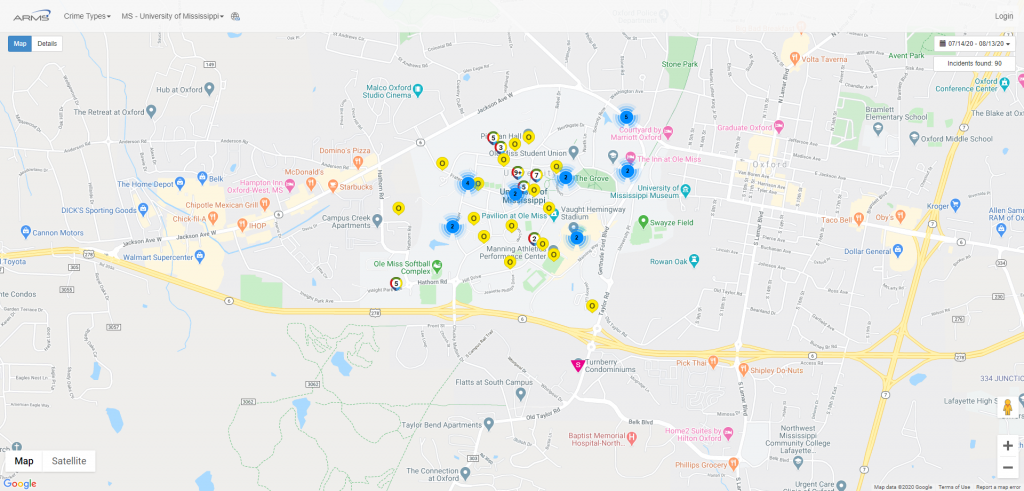
Our college and university customers use the Clery Mapping Portal in place of the required Clery Daily Log. If your department is currently having to: Review all incidents to decide which are Clery Reportable Create a PDF of all the required data Send to someone on campus who has access to post this PDF to your website Repeat daily Then it’s time for a change! ARMS automatically collects required fields from your Clery reportable incidents and posts the data on an automated web portal. With ARMS‘ help, you can avoid delays or human error that could result in huge fines from the DOE.